ADS-B In/Out installation.
SkyGuard Vision-Pro - UAT out, FIS-B in, TIS-B in,
UAT in, and 1090ES in.
July 14, 2014 Update
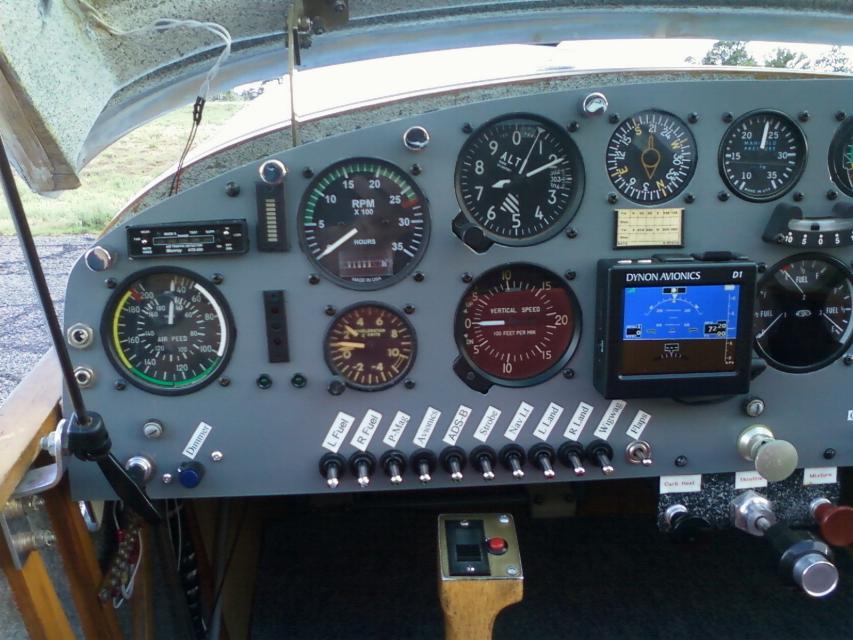
July 14, 2014 - A new switch
has been added to the panel. ADS-B.
I installed a 5 Amp circuit breaker to the far right side of the
panel and the switch shown in the
panel here. At the
other end is a SkyGuard Vision-Pro ADS-B unit mounted under the turtle
deck. All I had to do was supply power
and ground. With a wood and
glass aircraft, all the antennas
could be mounted under the turtle deck and it talks to my iFly 720 GPS
via
WiFi.
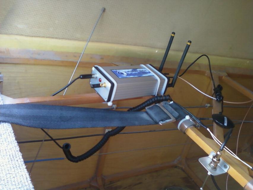
Installation was pretty straight forward. Just supply power and
ground. Plug the WAAS GPS puck into the unit. Plug in
the 978 MHZ and 1090 MHZ antennas.
Mount and plug in the ADS-B Out antenna.
Install the WiFi antenna (tiny nub on the front of the unit).
Turn on the power. The control panel for the unit
automatically
showed up under Menu on my
iFly unit, so I plugged in my ICAO number, N number, and squawk code
(1200), then took it out for a ride. Naturally, there was no
traffic in the area, but I noted that the FIS-B (weather) came up
immediately. Note: The transponder antenna in the picture is a
passive antenna used
by my old Monroy
PCAS unit and is not an active transponder antenna. The
other metal whip in the photo is for my ELT. The transponder
antenna is mounted much farther aft. The ADS-B
out antenna is
mounted along the near side of the wooden airframe, so does not appear
in the photo.
July 20, 2014 - Took the iFly
and SkyGuard Vision Pro for another flight today. Nice Sunday mid
morning with lots of traffic out and about. At first, I saw
nothing.
Not unusual since there isn't a lot of
traffic around our airport, and no ADS-B tower within range.
However, once I was at altitude and 30 miles out from the
Albuquerque
area, I was seeing
the various airliners coming and going from ABQ as well as some traffic
around Double Eagle Airport. I flew back up over Santa Fe at
11,500'. From
that altitude, I was still displaying traffic over
Albuquerque and was also picking up some traffic in the Santa Fe area.
Since
radar is new to Santa Fe, it's not tied into the
ADS-B system, so the
only traffic I was picking up was either 1090ES, UAT, or was high
enough they were
still being painted by Albuquerque Center. Traffic was painted
with an directional arrows and altitude. The traffic is also
color coded
with aqua blue
for traffic, blue
for potential conflict traffic, and red as a traffic
alert. I also noted that
traffic appeared and disappeared quite regularly, so
I wouldn't want to hang my hat on this unit as a replacement for the MK
1 eyeballs. However, when it started painting
a potential conflict,
know the altitude and direction of the other aircraft made spotting it
a cinch.
July 26, 2014 - I went for
another flight this morning for the express purpose of capturing some
screen shots of the ADS-B traffic.
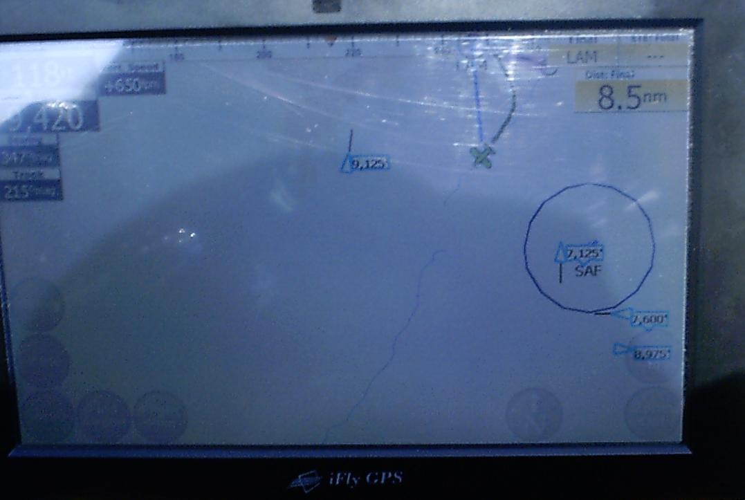
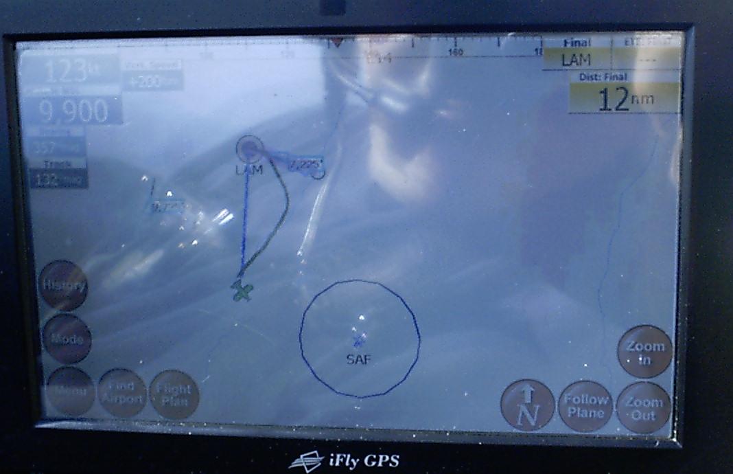
I've just launched from LAM and am over the Rio Grande half way between
LAM and SAF. The ring around SAF is the 5 mile ring of controlled
airspace around SAF.
Note there are a number of targets in the pattern around Santa Fe.
The ones off to the south are likely doing instrument work.
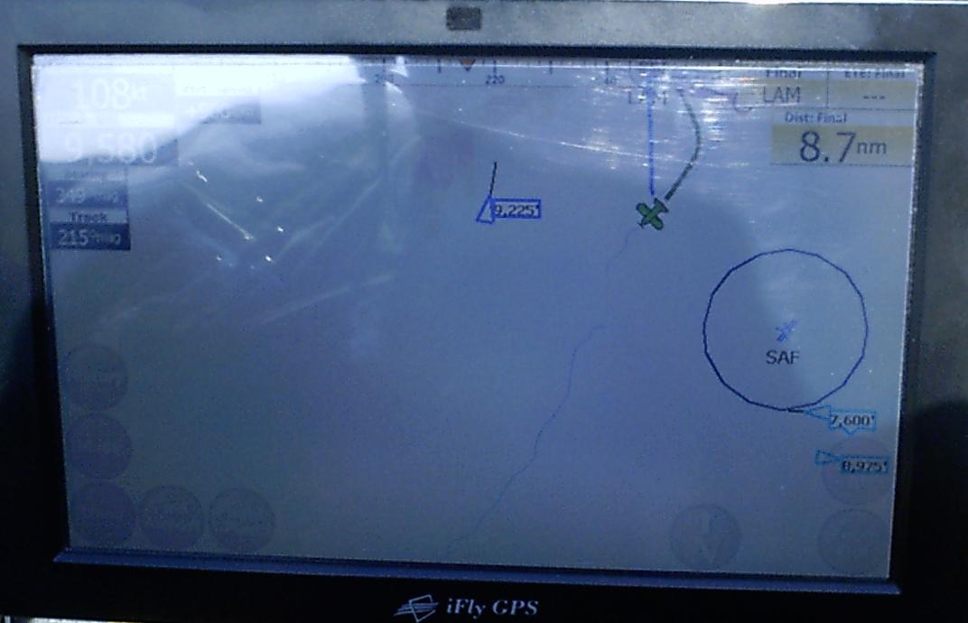
.2 NM later, the plane to starboard gets highlighted as blue, which
indicates it is in close enough proximity that it is painted blue to
draw my attention. Also note the target
that was previously on right downwind for runway 20 is gone as it is
likely just below ABQ Center's radar.
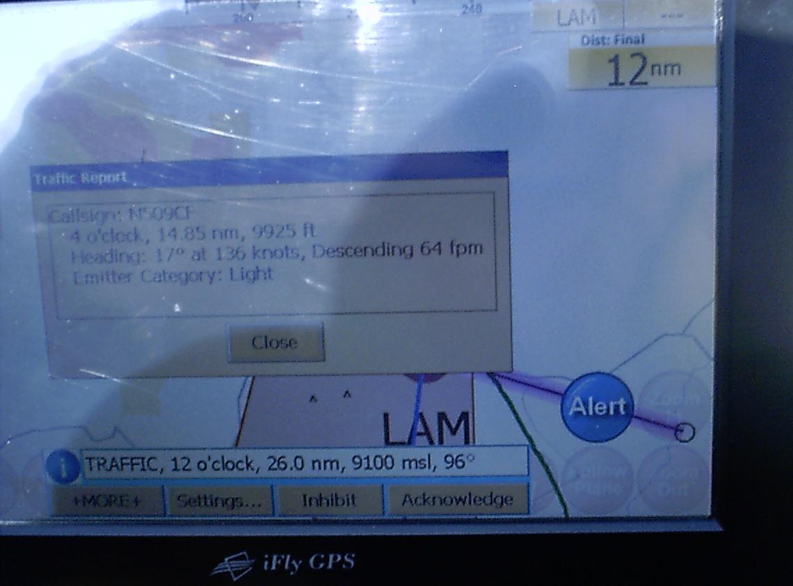
I grabbed this screen shot after I selected traffic that was 26 NM out.
This aircraft was clearly broadcasting it's position via 1090ES.
I looked up the registration number
after I got home and found it to be a Care Flight helicopter headed for
Albuquerque.
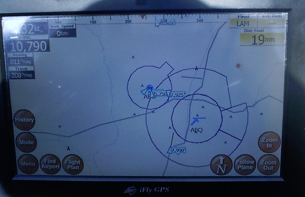
This screen shot captures the traffic around Albuquerque at that moment
this morning. It looks pretty busy over at AEG (Double Eagle) on
the west side this morning.
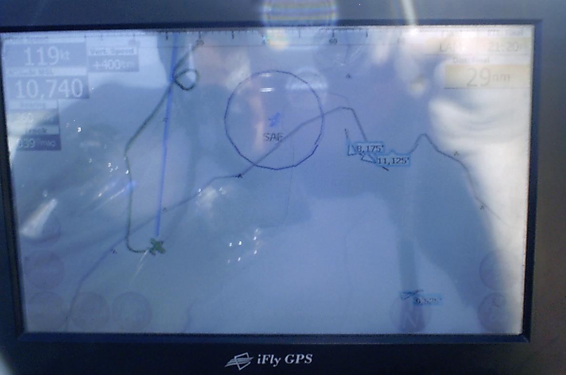
This shot is showing some traffic SE of SAF. I selected the
traffic for more information as shown in the next photo. This
screen just depicts the normal display but is
here to use as a reference for the next photo.
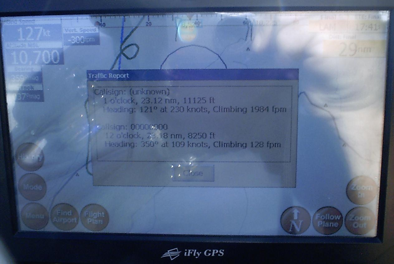
After selecting the traffic, here is the information being provided.
The top aircraft that was at 11,125' is clearly a bizjet climbing
out of SAF since it's dong 230 kts and
climbing at 2000 fpm. The second target was actually an
acquaintance doing instrument approaches into SAF in a C-172 Cutlass.
You can tell it's a light aircraft by
the performance numbers.
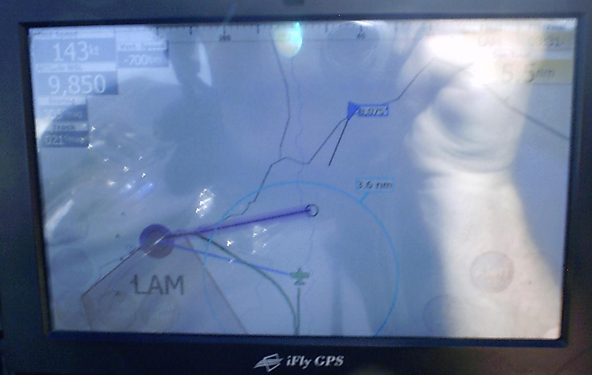
This series of three photographs depicts using this to deconflict with
traffic. Both of us are headed for the circle that's about half
way in between us and is where one is
supposed to turn final for runway 27 for LAM. This is a C-182
that I know just got all new avionics, so is broadcasting ADS-B out on
1090ES. We were communicating
with each other at this time as well.
My KR is significantly faster than a Skylane, so I pressed on and
turned in towards the runway just a bit while he looped his turn out
just a bit.
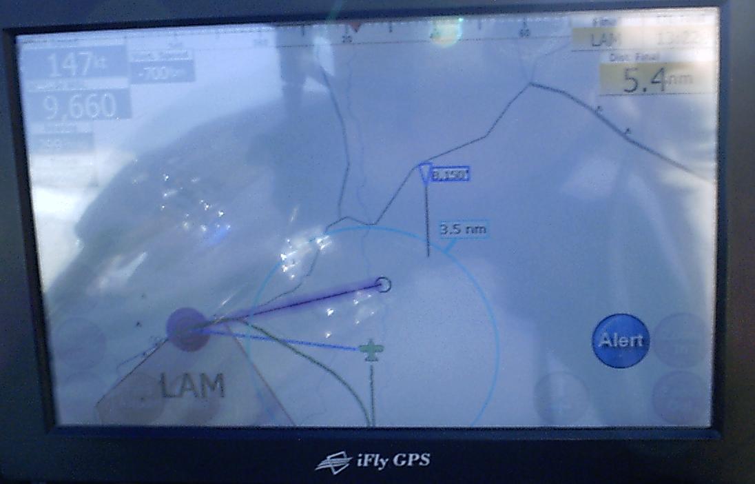
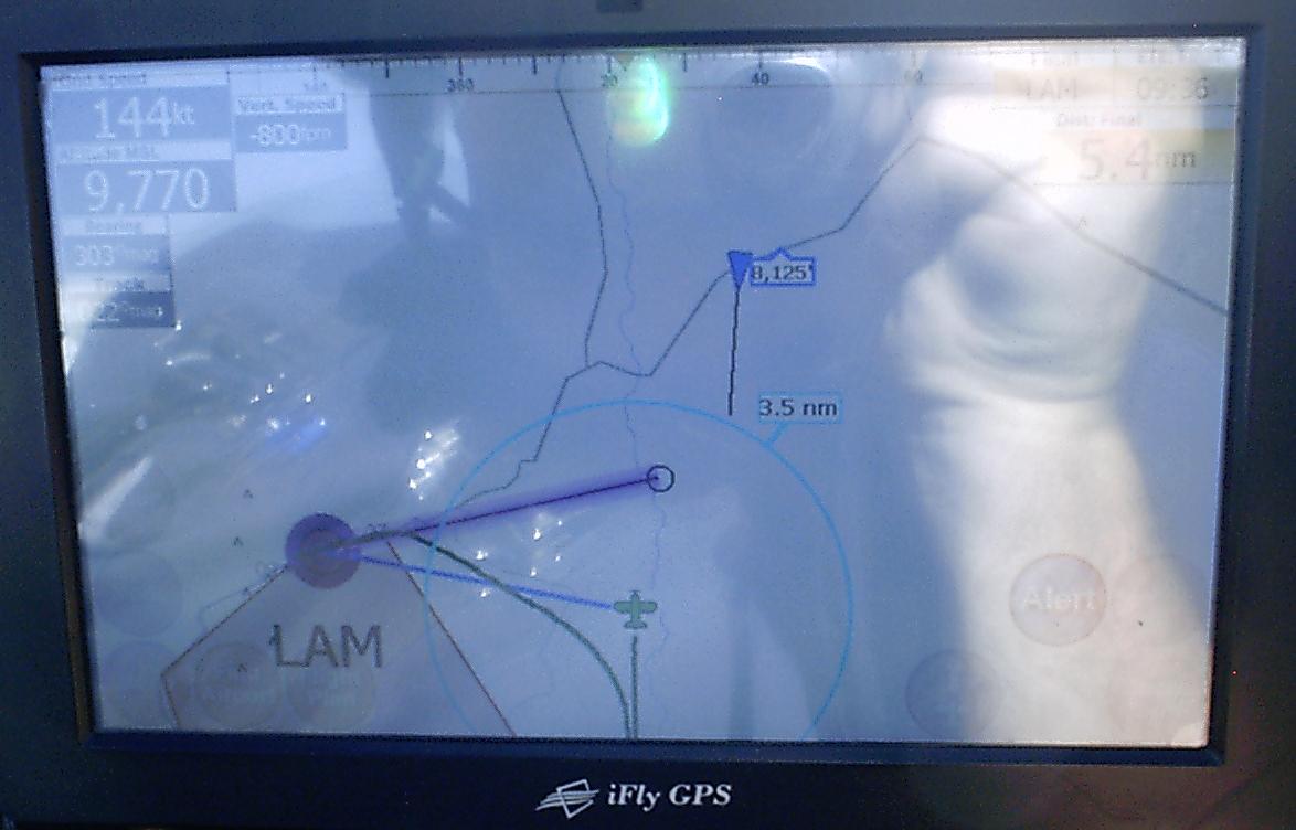
Here we are pretty well deconflicted. I believe he also has ADS-B
in, so probably saw me on his cockpit display as well. This is
the way the final implementation of
TIS-B is supposed to work. Note we are still approximately 5
miles apart (the ring around me in this display is 3.5 miles). At
5 miles, there is no way we could acquire
each other visually.
I grabbed this screen shot as I didn't think Center could track planes
this close down to Los Alamos. Ground level at Los Alamos is
7171' and this was a Piper Comanche
that was showing 7225'. I checked with the Comanche and he
only had a Mode C transponder and no ADS-B out, so the data was a
retransmit of FAA Radar data
via ADS-B..
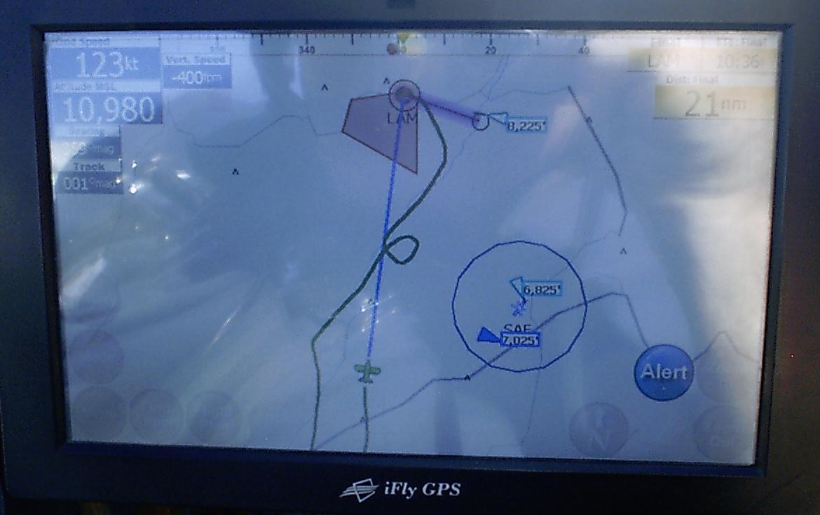
This screen shot was to capture a friend in his Cessna 140 that was
just starting his approach to land on rwy 27 in Los Alamos. His
Mode C transponder was reporting
8225'. Center didn't pick him up again after this point.
So, I think we all know Mode C only reports in intervals of 100'.
My friend told me he was at 8500'. So, this
must be the corrected pressure altitude from ABQ Center. Only
problem here is that usually the barometric pressure in Albuquerque
always significantly different from
Los Alamos, so he is indicated 275'' low. Note in the
previous photo
the Comanche was showing 7225', so he was likely at 7500', which would
have been about right
for that position while on approach to LAM. But remember, this
device is here to help you visually acquire traffic. Exact
position + or - a couple o fhundred feet is close
enough I can eaqsily acquire with the Mk 1 eyeballs once I'm close
enough to see them.
We have some weather moving in tomorrow, so if I get a chance, I'll put
up some screen shots including some weather as well.
Feel free to email me with comments or questions at
jscott.planes"at"gmx.com.
Stay tuned. More to come...
-Jeff